Recreational Modification Projects
The Chatfield Storage Reallocation Project participants have completed the recreational modifications at Chatfield State Park to address any impacts of additional water storage. To learn more about the modifications, please click on the below recreational areas.
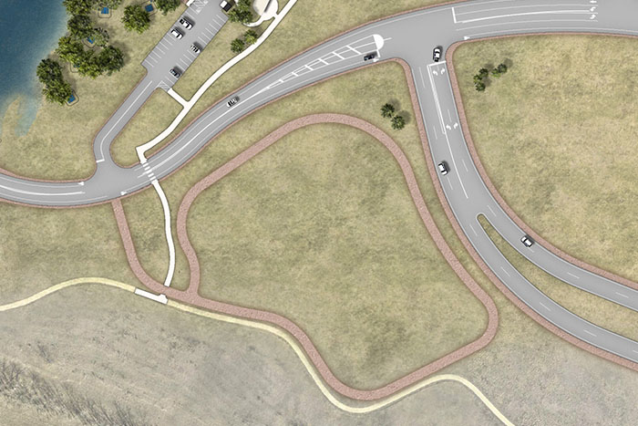
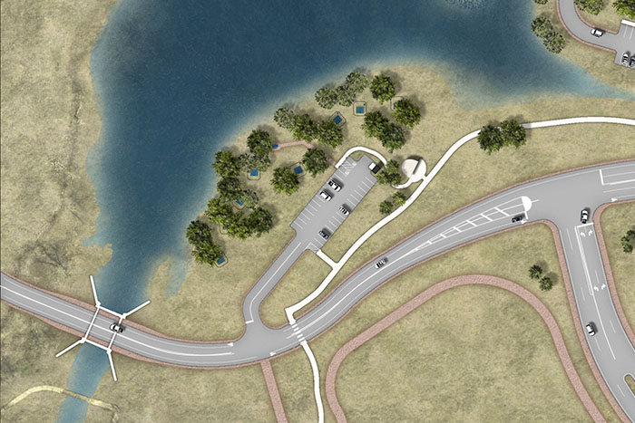
PROJECT MODIFICATIONS: The Perimeter Road was relocated and elevated to provide in-kind flood protection. The Deer Creek Day Use Area was modified and located adjacent to the Balloon Launch area providing access to restroom facilities, drinking fountains, picnic tables, grills, benches, trash container, and an information kiosk. Existing pedestrian trails were replaced in-kind. Landscape is being restored in a native condition similar to what existed before.
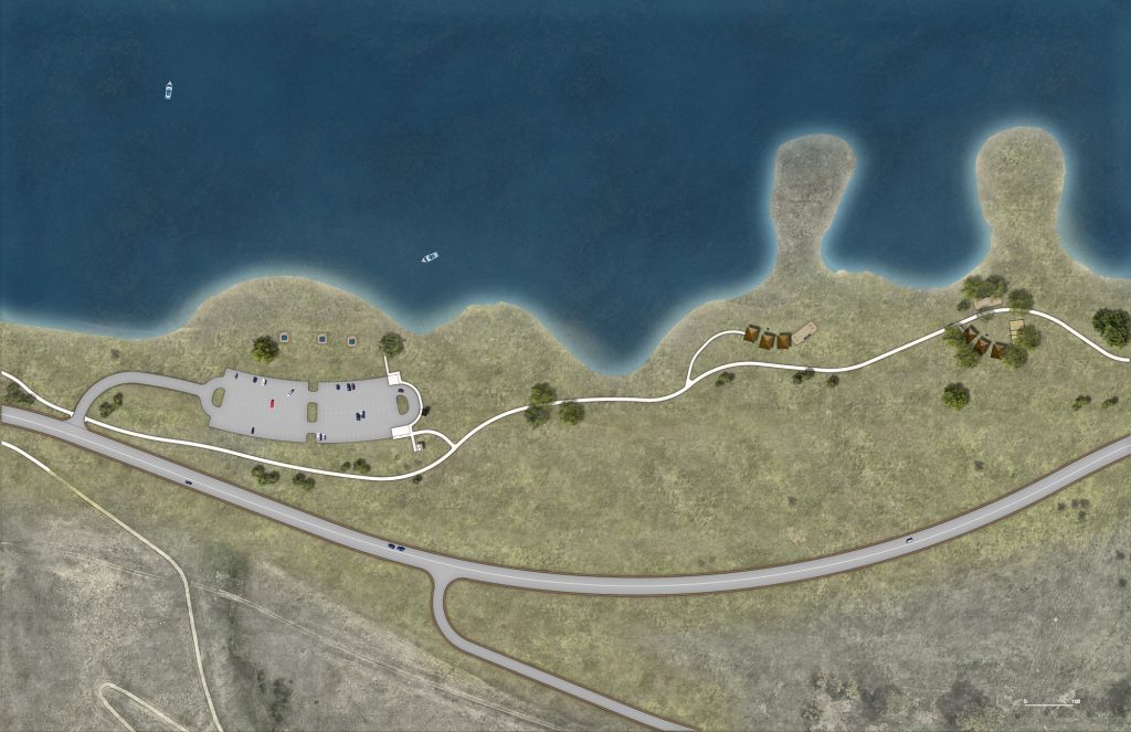
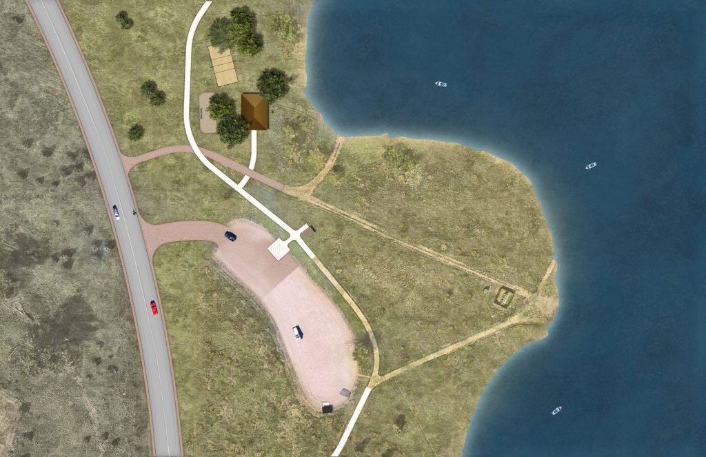
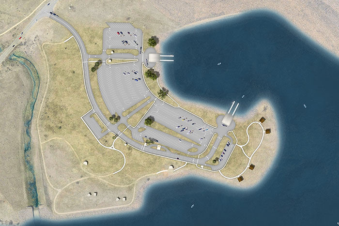
PROJECT MODIFICATIONS: The Catfish Flats Day Use Area and the Park Perimeter Road were moved further uphill and elevated to provide in-kind flood protection. The new access drive connects directly to the Perimeter Road. The asphalt parking lot was replaced in-kind with five (5) of the spaces modified for ADA compliance. All existing recreation features were either relocated or replaced in-kind. Landscape is being restored in a native condition similar to what existed before.
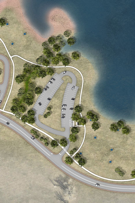
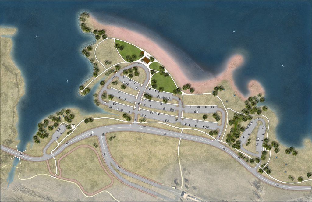
PROJECT MODIFICATIONS: The Perimeter Road was relocated and elevated to provide in-kind flood protection and access to the Deer Creek Day Use area. The Area was also moved a short distance and located adjacent to the Balloon Launch area. With the higher water levels in the Reservoir and the modifications to the site, there is increased shoreline access from the Deer Creek Day Use Area. New or relocated facilities include a parking lot, picnic tables with grills, trash containers, pedestrian trails, and the Deer Creek pedestrian bridge. Landscape was restored in a native condition similar to what existed before. The linear Cottonwood grove at the shoreline was reestablished at a higher elevation.
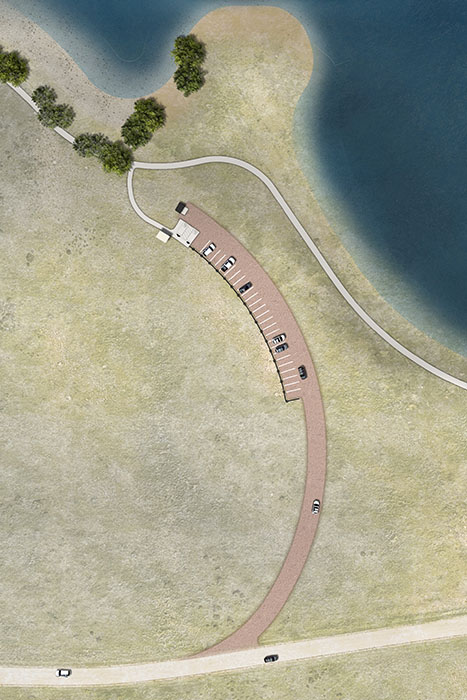
PROJECT MODIFICATIONS: The gravel parking lot was moved further uphill along with the Park Perimeter Road to provide in-kind flood protection. With the higher water levels in the Reservoir, shoreline access was maintained. All existing recreation features were relocated or replaced in-kind. Three of the existing relocated parking spaces have been designated ADA. Landscape is being restored in a native condition similar to what existed before.
PROJECT MODIFICATIONS: The stables were not impacted by environmental mitigation or recreation modification and were not modified. However, the stable entrance road has been relocated to the south to accommodate the new alignment and elevation of the Perimeter Road. The Equestrian trail inundated by higher normal water levels in the Reservoir were elevated to provide in-kind flood protection and reconstructed with the natural surface materials available along the new trail alignment.
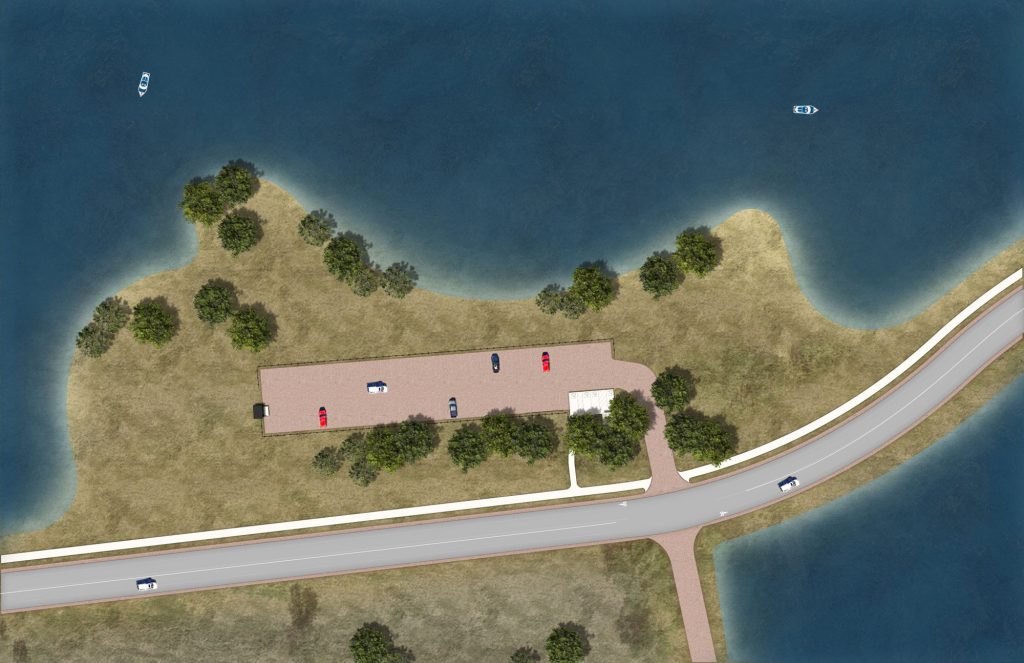
PROJECT MODIFICATIONS: The Fox Run Day Use Area was redeveloped generally in the same location as the existing facilities. A new access drive is constructed along the same alignment as the existing but regraded to meet the elevation of the new Perimeter Road. The existing gravel parking lot remains, with two (2) of the spaces modified for ADA compliance. The portable restrooms were replaced with vault restrooms. All existing recreation features were either relocated or replaced in-kind. Landscape is being restored in a native condition similar to what existed before.
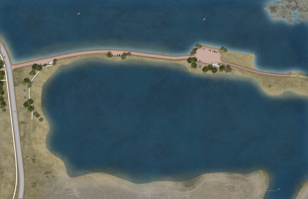
PROJECT MODIFICATIONS: The Gravel Pond was redeveloped generally in the same location as the existing facilities. The access drive was reconstructed along the existing alignment and raised to meet the elevation of the new Perimeter Road. Elevating the Gravel Pond Road also provides in-kind protection from flooding from the South Platte River to preserve water clarity in the Gravel Pond. Two existing gravel parking lots were reconstructed generally in their existing location with a total of five spaces modified for ADA compliance. All recreation features, including picnic tables, benches, and dumpster enclosures were relocated or replaced in-kind. The existing portable toilets were replaced by vault restrooms. Landscape is being restored in a native condition similar to what existed before.
PROJECT MODIFICATIONS: The Jamison Day Use Area and the Park Perimeter Road were moved further uphill and elevated to provide in-kind flood protection. Vehicle access from the Swim Beach was eliminated and a separate access from the Park Perimeter Road was provided. All existing recreation features were relocated or replaced in-kind. Landscape is being restored in a native condition similar to what existed before.
PROJECT MODIFICATIONS: The Kingfisher Day Use Area was redeveloped generally in the same location as the existing facilities. A new access drive was constructed adjacent to the existing and regraded to meet the elevation of the new Perimeter Road. The existing gravel parking lot was raised and rebuilt in-kind to the existing with two (2) of the spaces modified for ADA compliance. The portable toilet was replaced with a vault toilet and a yard hydrant was installed. Landscape is being restored in a native condition similar to what existed before.
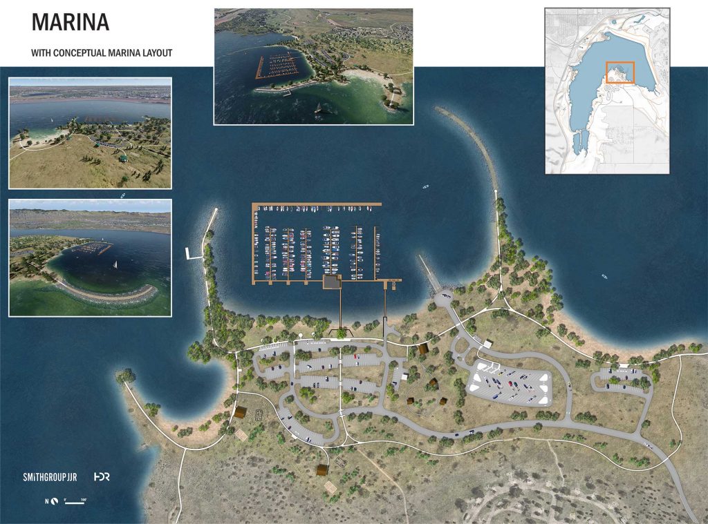
PROJECT MODIFICATIONS:: The land-side portion of the Marina and recreational facilities were moved uphill, elevated to provide flood protection, and relocated or replaced with in-kind facilities. In general, relocated recreation facilities are within the same or similar proximity to each other as existing facilities with some minor modifications to improve functionality. Landscape is being restored in a native condition similar to what existed before.
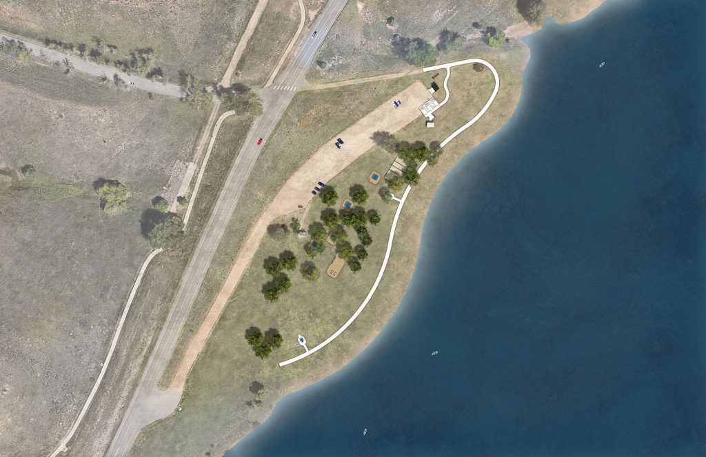
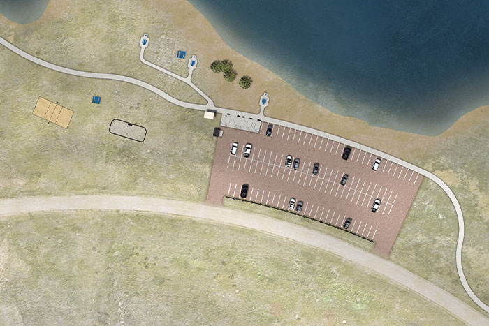
PROJECT MODIFICATIONS: The existing parking lot and access drive remains, with the addition of ADA compliant spaces. The existing site configuration was refined by relocating the vault restroom and dumpster to the north end of the parking lot to improve accessibility. The picnic areas and trail were reconfigured to also improve accessibility. Two ADA accessible and six regular picnic tables were provided and the volleyball court and horseshoe pit were replaced. Landscape is being restored in a native condition similar to what existed before.
PROJECT MODIFICATIONS: Due to existing site constraints, this site was redeveloped at the existing location with a similar configuration, but at a higher elevation to provide in-kind flood protection. The parking lot size, configuration, lighting, and ancillary features are identical to the existing. The restroom facilities along the west side of the site were not affected by the CSRP Project and were left in their existing condition. The picnic area along with the walks, and trails along the easterly end of the site were reconfigured to adapt to the new grading. Landscape is being restored in a native condition similar to what existed before.
PROJECT MODIFICATIONS: Any trails impacted by environmental mitigation or recreation modification were replaced in-kind providing the same or similar access to Park facilities.
PROJECT MODIFICATIONS: The gravel parking and restroom facilities were not modified but the two access roads from the Perimeter Road have been resurfaced. The South Platte River Trail was relocated to the east side of the South Platte River and was constructed as a natural surface path to accommodate the equestrian users, while also accommodating mountain bicyclists and hikers.
PROJECT MODIFICATIONS: The area was moved approximately ¼ mile southwest and elevated to provide improved level of flood protection. The gravel parking lot was reconstructed and five parking spaces modified for ADA compliance. All existing recreation features were either relocated or replaced in-kind. One ADA compliant picnic table was provided. Landscape is being restored in a native condition similar to what existed before.
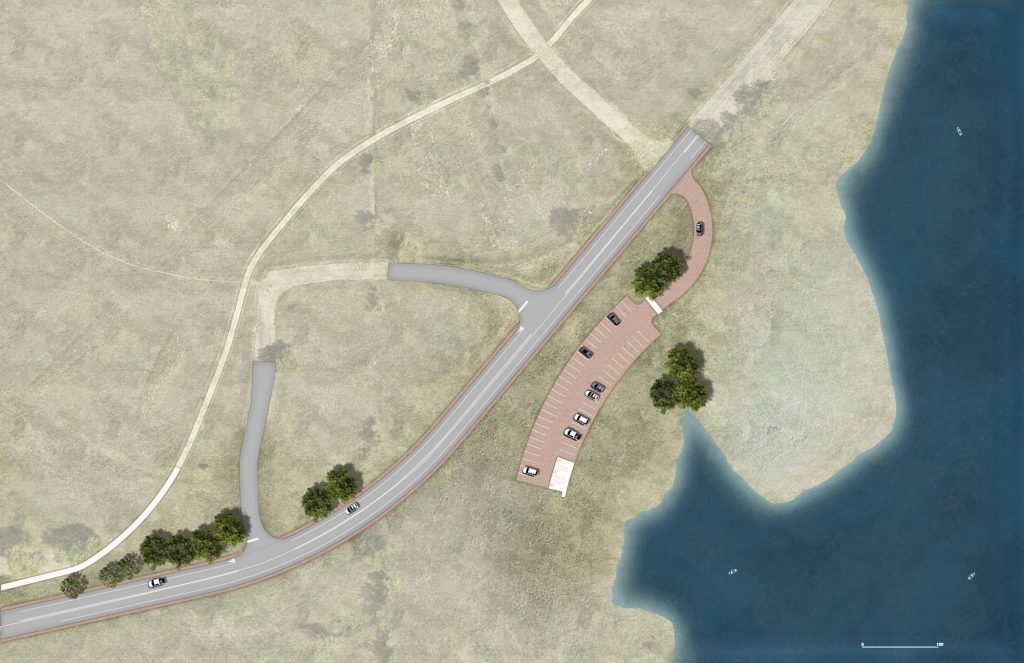
PROJECT MODIFICATIONS: The gravel parking area was moved uphill to the southeast and elevated to maintain the proximity to the Reservoir and trails. Two parking spaces were made ADA compliant, the dumpster enclosure relocated, and a new vault restroom constructed. Landscape is being restored in a native condition similar to what existed before.
PROJECT MODIFICATIONS: The Swim Beach recreation area and the Park perimeter road were moved to the west and elevated to provide access and in-kind flood protection. Reconfiguration of the Swim Beach area increased available parking, provided more detail to the buildings and sand beach, and improved the connectivity throughout the site. All existing recreation facilities and opportunities were re-established to in-kind level of service, except that the distance from the buildings to the shoreline increased from 130 to 340 feet due to greater fluctuations in the Reservoir water levels, but this also provides more beach area. Landscape is being restored in a native condition similar to what existed before.
Other Chatfield State Park Facilities and Activities
The Amphitheater was not modified as part of the Chatfield Storage Reallocation Project.
PROJECT MODIFICATIONS: Some sections of the trails were relocated during construction if they passed by or crossed through recreation areas that were being modified for the Chatfield Storage Reallocation Project. New trail systems were created in the Plum Creek and South Platte River areas, which included a connection to the Dam Overlook Trail, providing a continuous path around the Reservoir.
PROJECT MODIFICATIONS: Boat rentals were temporarily impacted during construction of the Chatfield Storage Reallocation Project, however, all operations have returned to normal.
For information on boat rentals, please call the Marina at (303) 791-5555 or visit the Chatfield Marina website.
The campgrounds, nor the facilities within the campgrounds, were modified as part of the Chatfield Storage Reallocation Project.
The Discovery Pavilion + Audubon Center was not modified as part of the Chatfield Storage Reallocation Project.
The Audubon Center provides critical habitat for an abundance of birds, other wildlife, and plants. Set alongside the South Platte River – an important wildlife corridor – the site offers visitors the chance to explore forests, shrublands, grasslands, ponds and wetlands. The classroom at the Audubon Center is outfitted with binoculars, aquatic sweep nets, insect nets, track molds, microscopes and more – to facilitate a hands-on approach to nature discovery. Native gardens attract butterflies and birds near the building while showcasing Colorado plants and organic gardening practices. A 200-seat outdoor amphitheater provides space for outdoor programming for larger groups. Check the Audubon website for schedule and details: http://www.denveraudubon.org/auduboncenter/.
The First Aid Station is located near the Swim Beach. It is open during the recreation season each year. Most park staff are trained in first aid and can assist during an emergency. In case of an emergency, call 911.
Colorado is world renowned for its wide array of outdoor recreation. Colorado Parks and Wildlife strives to make sure that everyone can access our special places and activities. For additional information on accessibility, visit http://cpw.state.co.us/aboutus/Pages/Accessibility.aspx.
There are two Overlooks – one is located near the Spillway on the west side at the north end of the Park and a second on the east side of the Park near Heronry Picnic Area. The two Overlooks were not modified as part of the Chatfield Storage Reallocation Project.
The Chatfield State Park Headquarters (Office) was not modified as part of the Chatfield Storage Reallocation Project.
The Chatfield State Park Headquarters is located inside the Park on the east side of the reservoir, between the Heronry Picnic Area and the campground. The Park office has staff available to answer questions and provide more detailed information as needed (beyond what can be handled at the park gates.) Telephone: (303) 791-7275. The mailing address is 11500 North Roxborough Park Road; Littleton, CO 80125. FAX is (303) 791-1231. Please check the Chatfield State Park home page for more information regarding fire bans: http://cpw.state.co.us/placestogo/Parks/Chatfield.
Some Group Picnic Areas and Picnic Sites were impacted by the project.
Please see additional information on Group Picnic Areas and Picnic Sites under North Boat Ramp, Massey Draw Day Use Area, Balloon Launch Area, Swim Beach, Jamison Day Use Area, Catfish Flats Day Use Area, Fox Run Day Use Area, Chatfield Marina, Roxborough Day Use Area and Plum Creek Day Use Area under Recreational Modification Projects above.
There are four reservable Group Picnic Areas throughout the Park. These areas are extremely popular, and typically need a reservation made well in advance of your event. Reservations begin the Tuesday following Martin Luther King Day in January. For more information please call the Park Office at (303) 791-7275, or check out the Picnicking link under “Park Activities” on the Chatfield home page. Please check the Chatfield State Park home page: http://cpw.state.co.us/placestogo/Parks/Chatfield.
A new floating facility was constructed as part of the Chatfield Storage Reallocation Project. The new building includes a full-service marina offering slip rentals, boat rentals, boat storage and Seagull’s restaurant.
Please contact the Chatfield Marina for information at (303) 791-5555 or check their website at www.chatfieldmarina.com. Services available seasonally.
Some of these restroom facilities were impacted during construction of the Chatfield Storage Reallocation Project. See additional information on restrooms and showers under North Boat Ramp, Massey Draw Day Use Area, Balloon Launch Area, Swim Beach, Jamison Day Use Area, Catfish Flats Day Use Area, Chatfield Marina, Plum Creek and Roxborough Park Road Entrance Station under Recreational Modification Projects above.
The Perimeter Road from the South Platte River parking area around the west side of the Park to the North Boat Ramp, including West Access to the Park, access roads (secondary roads) and bridges and crossings in this area were reconstructed as part of the Chatfield Storage Reallocation Project.
The RV Dump Station was not modified as part of the Chatfield Storage Reallocation Project. It is located east of the South Platte River parking area south of the Campgrounds and near the Group Camping area on the Perimeter Road just to the west of the Roxborough Park Road Entrance Station. Potable and rinse water (non-potable) available. Open year round. User fee: $10.00 park entrance fee; $28.00 to dump.
The Chatfield Stables itself was not modified by the project. However, the stable entrance road was relocated to the south to accommodate the new alignment and elevation of the Perimeter Road.
Additional information on rides and rates is available at: www.chatfieldstables.com.
See additional information above on Gravel Pond under Recreational Modification Projects.
The Swim Beach is open seasonally from Memorial Day weekend through Labor Day weekend. Operating hours are sunrise to sunset. These hours are strictly enforced for your safety. There is no lifeguard on duty and all children under the age of 12 need to be supervised by an adult.
One Wildlife Viewing Area is located on the west side of the Park. Two other Wildlife Viewing Areas are located on the east side of the Park. All three Wildlife Viewing Areas were not modified as part of the Chatfield Storage Reallocation Project.

